

Why Cloud Peak? Well,
after setting out to climb Pike’s Peak last summer with my buddy Al Beilgard,
Al suggested a wilderness adventure in lieu of mountain climbing this year. Al and his wife, Nancee, had lived in north
central Wyoming for many years and this is a place he was familiar with, albeit
24 years had passed since his last trek.

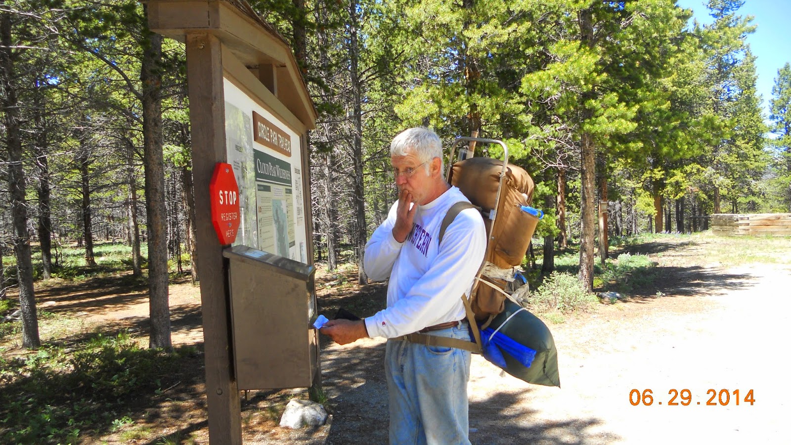
Our journey began at the Circle Park trailhead and for the most part stayed on trail 046 until the last leg and took trail 090 to Old Crow Lake. Unlike the Barr Trail going up Pike’s Peak which is practically paved and very wide, these trails were very narrow, rocky, and would peter out in several places leaving you to look for cairns and blazes for signs of which direction to go.
 There are several hundred beautiful
lakes cover the landscape and drain into miles of streams. The area is
characterized by an attractive mix of pine and spruce opened by meadows and
wetlands.
There are several hundred beautiful
lakes cover the landscape and drain into miles of streams. The area is
characterized by an attractive mix of pine and spruce opened by meadows and
wetlands.
And
since they were having what the ranger describes as a “late spring”, that meant
there is still snow and drifts to contend with.
Snow drifts at times would impede our path. Being too long and deep to cross we would
have to go around and then pick up the trail again later. Some times this proved to be a
challenge. Our journey began at the Circle Park trailhead and for the most part stayed on trail 046 until the last leg and took trail 090 to Old Crow Lake. Unlike the Barr Trail going up Pike’s Peak which is practically paved and very wide, these trails were very narrow, rocky, and would peter out in several places leaving you to look for cairns and blazes for signs of which direction to go.
There are several hundred beautiful
lakes cover the landscape and drain into miles of streams. The area is
characterized by an attractive mix of pine and spruce opened by meadows and
wetlands. I mentioned the trails being rocky. Boulders would probably be a better term than rocks. Navigating them gave us “dead legs”. And unlike the Barr Trail that starts out with quick, short switchbacks for a mile or so leading to an elevation climb of over a 1000 feet in that short span, this trail tended to rise and fall, gently ascending over several miles. I estimate we hiked about 6 miles or so reaching Old Crow Lake in about five and a half hours. We took our time, took breaks, took lots of pictures, took a wrong turn, and got lost for about an hour.
But we planned for being lost and had a compass and a topographical map to help us find our way again. No worries.

Sherd Lake is the first major lake we came to about two
miles in. All of the lakes are glacier
lakes and are very clear. Some are
shallow all across and some have a short shelf and drop off like an ocean. In the distance is Cloud Peak.

 Snow drifts! Large,
long snow drifts covering our trail. And
what you cannot see is that Rainy Lake is behind here but we could not access
it until we came back on our way out.
The warmer weather and rain we had everyday helped melt some of it away
and cleared a path to the lake.
Snow drifts! Large,
long snow drifts covering our trail. And
what you cannot see is that Rainy Lake is behind here but we could not access
it until we came back on our way out.
The warmer weather and rain we had everyday helped melt some of it away
and cleared a path to the lake.

This is Otter Lake
and we are about two-thirds of the way to our destination. Off to the right the area opens up to a
meadow and wetlands.


This is one of many
streams we had to cross. And because of
the amount of rain we had, this stream would be much higher and there were many
more streams to navigate on our way back down.
This is just about the time that we get lost. The trail just seemingly ends amongst the
wide meadow and wetlands. Two cairns
about 40 yards apart were the only signs but didn’t clearly mark the direction
of our trail. A third cairn would have
been nice. We started out in a couple
different directions but couldn’t find where the trail started back up. We ended up climbing a ridge to try and get a
view but there was too much thick timber to see much. This is where the topographical map really
came in handy. We were able to discern
which ridge we were on in relation to Otter Lake and the many ponds surrounding
us. We used our compass to find our
heading and started out again eventually picking up the trail. And when I say lost it was not like we were
wandering around. For the most part we
stayed still trying to sort it out. Al
and or I would walk a short distance in any one direction and come back. We'd continue to check our map and compass until we got our bearing and set out. All in all we lost about an hour.

Boulder fields; some small and some large; some stretching across only a few yards and some for hundreds; some easier to manage then others.


Boulder fields; some small and some large; some stretching across only a few yards and some for hundreds; some easier to manage then others.
Finally, we made it to Old Crow Lake. It was a really beautiful place and the timber was not so thick with several clearings for setting up camp.

This is the river flowing out of Old Crow Lake. All of the glacier lakes are connected by rivers or streams that flow into one and out to another. This one was rather large compared to others we saw and was not able to cross it.


After setting up camp and settling in a bit, we headed down to the lake and on the very first cast…BOOM…the trout hit my jig as soon as it hit the water. Wish I could say catching trout was as prolific as being one for one on every cast but we did all right.


Exhausted we rested a bit before taking on the next boulder field. But after 24 years, Al’s memory, slash intuition proved correct.

I figured out why they call it Lame Deer Lake. You can hear the stream rushing out of the
lake down the mountain side from a ways.
Deer having to cross those boulder fields to reach the water they are in
search of no doubt injured themselves and died before ever reaching it.

The lake itself was
deep. Surrounded by snow drifts
and large boulders, you could see submerged boulders for about 4 feet out and then
it just drops off to what looks like a bottomless lake. The views were spectacular. And like my first cast at Old
Crow…BOOM…bagged a beautiful rainbow trout on my first cast. I should give a special shout out to my
brother-in-law, George “Bear” Eoannou (Greek, pronounced similar to iguana only
the “G” is silent – that’s the best I can do) for making all my jigs. The two that hit the most were the rooster
tail and one I have no idea what it’s called, but it was bright orange. In the deeper lakes we used jigs and in the shallower waters we used flies.

Unfortunately though, clouds rolled in about 45 minutes into our fishing and started turning dark so we high tailed it back down. I estimate we meandered about 3 miles up but coming down we stuck closer to the stream and shaved it down to about a mile. Boulder fields are easier to manage going up then coming down, I will say that.
 There are only a few rules when
you are backpacking in protected, untrammeled wilderness. One of the more important ones is to let the
rangers know where you are going: how many in your party, your main
destinations, how long, etc. We filled out the forms the night before. I guess in our excitement the morning of our
adventure we forgot all about that and discovered our mistake somewhere along
our trek to Old Crow Lake. So, better to
submit our passes late then never at all, I guess. I did email my parents and siblings to tell
them where to look for our bodies prior to leaving the comfort of my home; so
at least there was that.
There are only a few rules when
you are backpacking in protected, untrammeled wilderness. One of the more important ones is to let the
rangers know where you are going: how many in your party, your main
destinations, how long, etc. We filled out the forms the night before. I guess in our excitement the morning of our
adventure we forgot all about that and discovered our mistake somewhere along
our trek to Old Crow Lake. So, better to
submit our passes late then never at all, I guess. I did email my parents and siblings to tell
them where to look for our bodies prior to leaving the comfort of my home; so
at least there was that.
And so, that is some of the pictures taken and points of
interest for us on our little wilderness journey. I do, however, have some lessons learned,
slash advice for would be wilderness adventurists. I will put these in no particular order
except for the first one which I feel is primarily the most important and
profound. Unfortunately though, clouds rolled in about 45 minutes into our fishing and started turning dark so we high tailed it back down. I estimate we meandered about 3 miles up but coming down we stuck closer to the stream and shaved it down to about a mile. Boulder fields are easier to manage going up then coming down, I will say that.
#1 – You are going to get lost! It is just a fact. Better to go in knowing this then to be
blissfully blind to this fact. Expect to get
lost and then prepare for it. At least
then you may not freak out about it when you come to that realization that it
is actually happening to you. Now; Right
now. My advice is to relax; Take a deep
breath; Recognize it is what it is (would it were what it isn’t); and, use some
common sense and instinct. A compass and
a topographical map are musts. In thick
wilderness as we encountered with tall spruce and pine trees, some overcast
skies, a trail that ends, it is hard to know your way. You cannot see the sun as reference and you
just get disoriented. Trails are not
straight paths. They meander and go up
and down, twisting, and turning sometimes in inexplicable ways because you do
not know what is ahead of you.
Stop! Take a look around you and
look for blazes (carvings in trees that serve as markers) or cairns (pronounced
“Karens” and are stacked rocks). And if
you are near running water (or can at least hear it), stick close to it. Running water always leads to somewhere you
want to be or go. Plus, you need water
to survive.
#2 – Equipment is key.
I don’t know who is right between my backpack and Al’s vintage one. They both served their purpose and got the
job done. Not sure what the liter size
is of Al’s but its aluminum external frame made it easy to pack things like
sleeping bag and tent on the outside and left plenty of room inside the pack. The modern day ones like mine hold most
everything inside and compresses everything to your body and bears the weight
on your hips. My pack was a Kelty Coyote
80 liter and I needed almost all of it for how long we were going.
Besides the pack itself is what you pack inside it that
makes the difference. My semi-mummy
sleeping bag was rated at comfortable to about 28 degrees and is
waterproof. Good thing too. We tested both. The temperatures for the most part stayed in
the 30s at night but with all the rain and coming and going from the tent water
would get in. Speaking of the tent, it performed
spectacularly. The tent itself was water
repellant and the cover was water proof.
The only part I was concerned with was the tent floor. We had a lot of rain; a lot of rain. She kept us safe and warm from the
storms. Another key equipment was my water bottle. I bought a new one this year which is a Camelback liter bottle with a UV light as a cap. You charge it using a USB cable and treats up to 80 liters of water. on a single charge. All you do is turn it on and then agitate for 60 seconds. Brilliant!
Lastly, I need to mention my hiking poles. We saw a lot of people use them on their way
up and down Pike’s Peak and I have to admit I thought this was some preppy
hiking thing. But talking to avid hikers
they swore by them. Nancee bought Al a
pair for Christmas and that really got my interest peaked. When I consulted the good folks at Sunflower
Outdoor and Bike Shop in downtown Lawrence I was sold. Best…investment…ever…for this kind of
trip. Using the hiking poles and my arms
probably deflected up to 20% of the weight from my legs at any one time. This is especially true climbing up when you
can dig a pole in and help pull and push off.
Coming down it is more about control than anything else, I think. They
saved me no less than 5 times from either face planting or falling backwards
and that was just on the ascent. Coming
down is like a controlled free fall at times and the poles are nice to steady
yourself and maintain that control.
#3 – Cairns are your friends. This goes with #1 above. Be aware of your surroundings and look for
signs. Cairns are suppose to communicate
to hikers but doubt many do. For
example, the higher a cairn is stacked the more peril. Also, the top rock IS SUPPOSE TO indicate a
direction but most do not. Still, they
are a most welcomed sight no matter how tall or small, no matter what. If you see one, look closer and scan the area
for an additional one. Usually they are
fairly close together to lead you in a direction (either the way you want to go
or the way you want to return).
My #4 piece of advice is “cotton kills”. If Al never hears me say (or sees me write)
that phrase again I am sure he will be happy and content. It is my mantra when hiking/camping. And it is true! Cotton feels all so comfy and warm until it
gets wet. It does not have the ability
to expel moisture. Instead it traps it
between it and you. You will be cold and
miserable and if temperatures are below freezing it really could mean very bad
things for you; including ultimately your death.
Every stitch of clothing I took was dry wick, water
repellant or water proof, and even UV protected with SPF protection. That last part was pretty important because
of the elevations we were at and our exposure to the sun being magnified (when
it wasn’t raining). I was very dry and
comfortable the entire time. Well, except for about 20 minutes when I fell into
a stream coming back down.
There had been so much rain we encountered streams that were
not there on the way up. I am not sure
what happened. With streams you pick out
rocks and clumps of grass to hop from and work your way across. Everything
happened so fast and in slow motion at the same time if that makes any
sense. I was doing my hopping and
somehow, some way my right foot ended up submerged calf high in the water. As it was all happening and I was teeter
tottering and trying to balance myself with poles, throwing my weight around and trying not to lose balance and fall in, I am doing this crazy Steve
Martin like contortions. I eventually went down. And even though my socks were dry wick and
boots water proof, when you submerge them as I ultimately did and face plant
into a stream, water is going to get in.
But really I was fine. My boot
and socks didn’t slosh as you might expect.
The sock and boot both absorbed the water quickly and began to wick it
away. Al asked if I needed to stop and
change socks and it was not needed. When
we got up to Rainy Lake (the one completely impeded by snow banks on our ascent)
we stopped and I took that opportunity to change socks and let the soaked ones
dry in the sun. In about 20 minutes they
were completely dry again. Great
gear!
And I will give a shout out to Frogg Toggs. My sister Deb told me about this rain suit
last year before we hiked up Pike’s Peak.
They are paper light and completely water proof; plus, they breathe!
They were awesome. The only downside to
them is they did not fold up and compress very well which means they took up a
lot of space in my backpack. But they are an essential piece of equipment.
So there you have it.
Cloud Peak Wilderness Area and I survived to tell about it.
The pictures are beautiful and I swear by my hiking sticks so glad you got them.
ReplyDelete